


North East Wales Map Print
£35.00
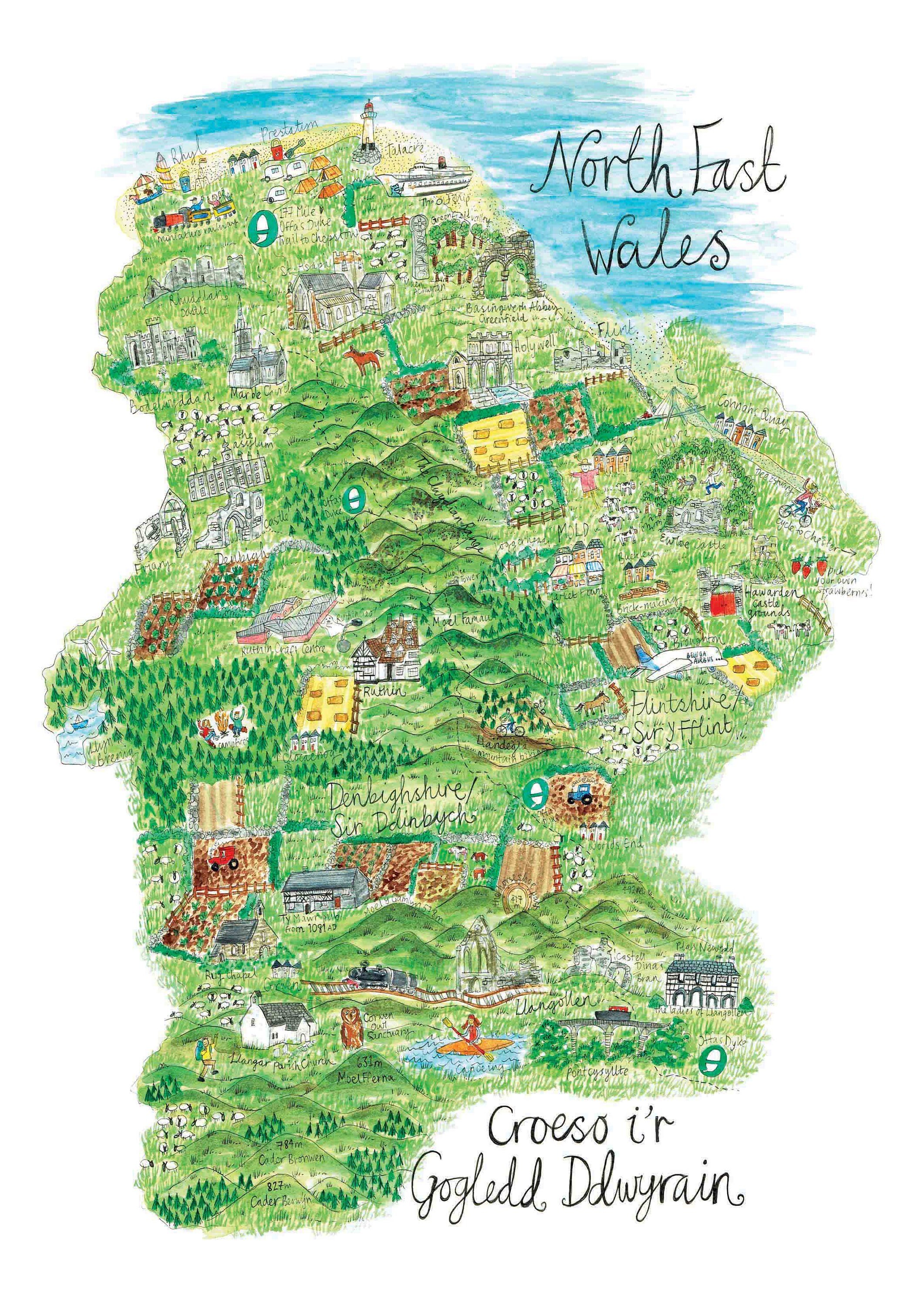
A print of my illustrated map of the North East of beautiful Wales- showing the counties of Flintshire and Denbighshire and containing all of the beautiful landscapes, some cultural highlights, walking tracks and towns and villages of the region. The map itself has been researched and curated by myself and was originally hand painted with watercolour and gouache.
This map is printed onto A3 size Hahnmule German etching paper and is a giclee archival print.
Print is sold unframed and posted flat in a bio-cello sleeve with card backing for protection where possible. International orders may be rolled in a tube.
Postage is via Royal Mail 2nd class in the UK, please upgrade if you require a quicker delivery, or for a tracked and fully insured service.
International postage is via Royal Mail estimated 5-7 days.
Please get in touch if you have any questions about this piece.
Quantity:
A print of my illustrated map of the North East of beautiful Wales- showing the counties of Flintshire and Denbighshire and containing all of the beautiful landscapes, some cultural highlights, walking tracks and towns and villages of the region. The map itself has been researched and curated by myself and was originally hand painted with watercolour and gouache.
This map is printed onto A3 size Hahnmule German etching paper and is a giclee archival print.
Print is sold unframed and posted flat in a bio-cello sleeve with card backing for protection where possible. International orders may be rolled in a tube.
Postage is via Royal Mail 2nd class in the UK, please upgrade if you require a quicker delivery, or for a tracked and fully insured service.
International postage is via Royal Mail estimated 5-7 days.
Please get in touch if you have any questions about this piece.
This map is printed onto A3 size Hahnmule German etching paper and is a giclee archival print.
Print is sold unframed and posted flat in a bio-cello sleeve with card backing for protection where possible. International orders may be rolled in a tube.
Postage is via Royal Mail 2nd class in the UK, please upgrade if you require a quicker delivery, or for a tracked and fully insured service.
International postage is via Royal Mail estimated 5-7 days.
Please get in touch if you have any questions about this piece.